— ExhibitC
— Exhibit -
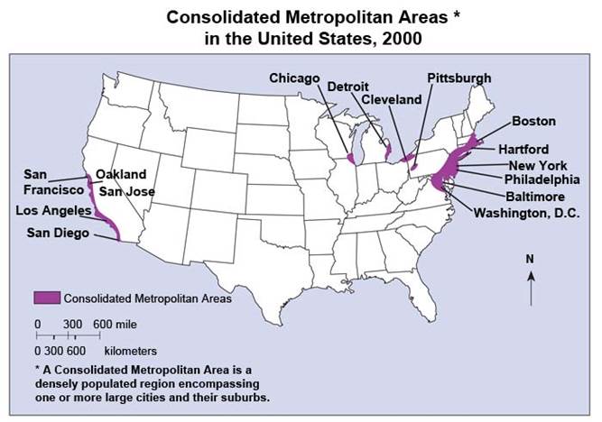
According to the map above, which of the following U.S. regions was the most densely populated in 2000?
A . Rocky Mountain states
B . central Great Plains
C . northern Great Lakes
D . Gulf of Mexico coast
E . northeast coast
Answer: E
Latest GED Social Studies Dumps Valid Version with 300 Q&As
Latest And Valid Q&A | Instant Download | Once Fail, Full Refund
